Products
Industries
About Geodetic
Products
Industries
About Geodetic
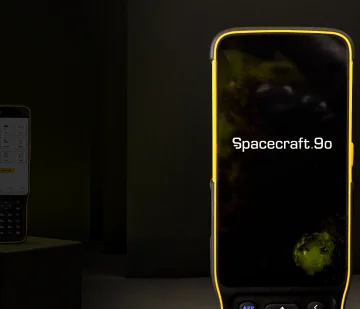
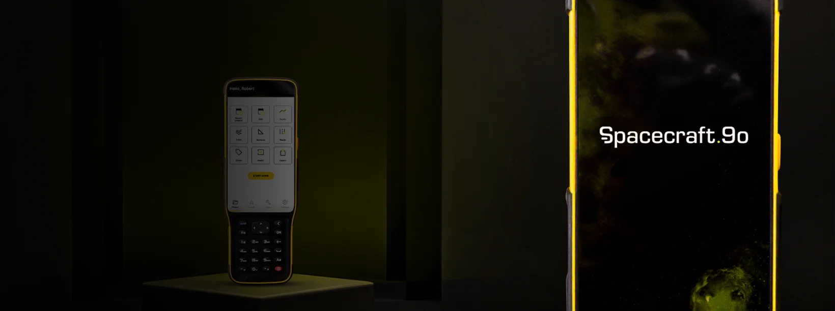
Embark on excellence with Geodetic Spacecraft your ultimate Android data collection solution.
Step into a world of unrivaled efficiency with Geodetic Spacecraft Software, the proven data collection powerhouse designed for Android devices and GEODETIC data controllers. Unleash customization at your fingertips through its modular design, tailoring the user interface to precise requirements, ensuring seamless deployment to field teams with unmatched efficiency. Experience mapping like never before with Geodetic Spacecraft’s advanced graphics rendering, elevating your field encounters to unprecedented heights.
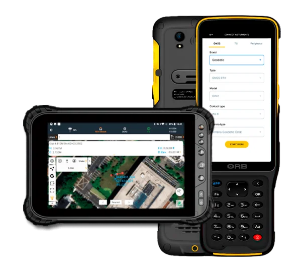
Built around intuitive workflow management and a user-friendly graphical interface, Geodetic Spacecraft propels high-precision surveying and mapping projects to new horizons of efficiency. From construction surveying to CAD project support, swift and accurate stakeouts, road construction, GIS data acquisition, and beyond, Geodetic Spacecraft's versatility integrates all surveying essentials seamlessly. Its industry-standard data import and export prowess ensures smooth integration into your existing software environment, guaranteeing instant productivity.
Elevate your surveying journey with Geodetic Spacecraft, where customization, precision, and unmatched performance converge.

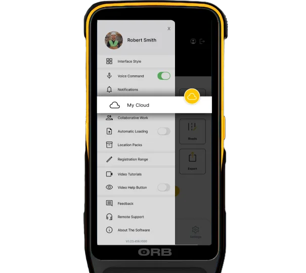
Experience Geodetic Spacecraft's captivating essence through its user-centric design, boasting spacious map displays adorned with vibrant graphics, effortlessly enhancing the surveying and mapping journey for every user. Embracing simplicity, Geodetic Spacecraft showcases only pertinent details, cleverly concealing unused functions, ensuring an effortlessly streamlined operation. Unveiling a realm of mastery, integrated video tutorials empower field operators to swiftly conquer the app's intricacies. A testament to versatility, its modular architecture grants boundless flexibility, while its abundant array of features positions Geodetic Spacecraft as the quintessential solution catering to a myriad of application demands.
In the realm of project creation, Geodetic Spacecraft unveils a seamless dimension of simplicity. Unleash the power of QR code scanning to effortlessly replicate coordinate settings, control points, and stake-out information from alternative handheld controllers. Convenience reigns as projects are elegantly curated, categorized, and revised through historical references and distinctive attributes, ensuring effortless navigation. Empowering precision, custom coordinate systems, geoid models, and codification libraries dynamically evolve through resource packages.
Geodetic Spacecraft's brilliance extends with a user-friendly site calibration wizard, tailored to empower non-experts with uncomplicated mastery.
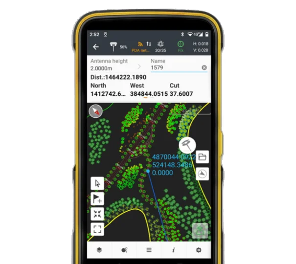
Immerse yourself in the Geodetic Spacecraft experience, where the MetaCAD graphics engine takes center stage, ushering in a realm of swifter, more seamless DWG and DXF base map access. Witness a metamorphosis in user interaction as rendering becomes a symphony of fluidity and efficiency. The extraordinary unfolds before your eyes – DXF files of up to 200 MB, unveiled on GEODETIC handheld controllers in less than 10 seconds. Experience the realm of brilliance through Geodetic Spacecraft's smart base map features, where QR CODE shines as a symbol of efficiency, effortlessly summoning line features with just one click, ultimately enhancing project productivity.
Geodetic Spacecraft's embrace extends to external reference files, deciphering CAD length units, and facilitating on-the-fly CAD base map enhancements, directly within the field.
Enter the world of Geodetic Spacecraft, meticulously crafted around a unified cloud-driven structure that powers project backup, collaborative endeavors, secure data retention, and a myriad of invaluable attributes. Empowering the essence of support, its remote assistance capability empowers the helpdesk to seamlessly troubleshoot user queries and extend personalized technical guidance. Elevate efficiency through the QR CODE, as users orchestrate swift project data exchange between office terminals and field controllers or amongst diverse field controllers, fostering a symphony of work efficiency.
Message successfully sent
Complete the form below and we'll be in touch.